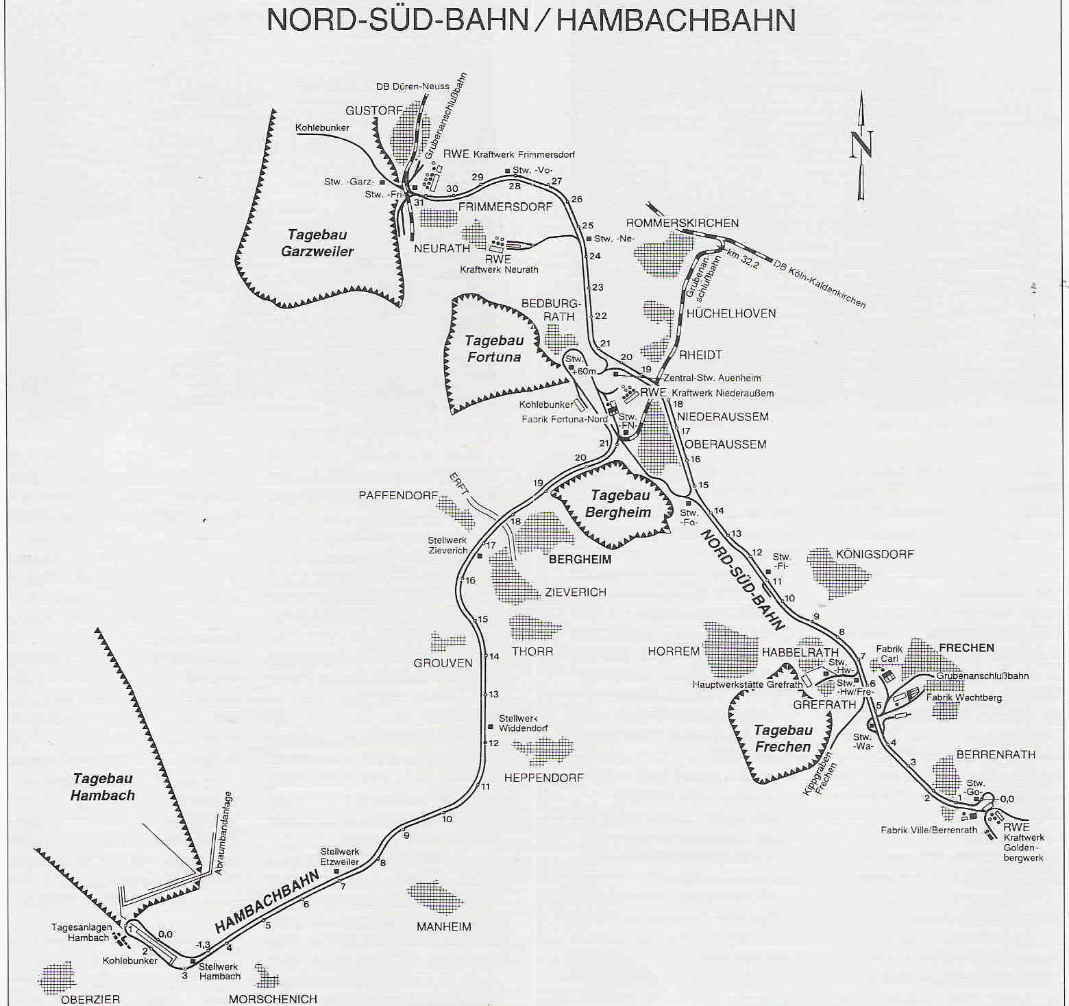
File:Rheinisches Braunkohlerevier DE.png
Summary
| Description | ||||
| Date | September 2018 | |||
| Source |
Own work
|
|||
| Author | Thoroe | |||
| Permission (Reusing this file) |
|
|||
| Other versions |
|
 |
This economic map image could be re-created using vector graphics as an SVG file. This has several advantages; see Commons:Media for cleanup for more information. If an SVG form of this image is available, please upload it and afterwards replace this template with {{vector version available|new image name}}.It is recommended to name the SVG file “Rheinisches Braunkohlerevier DE.svg”—then the template Vector version available (or Vva) does not need the new image name parameter. |
 |
This map has been made or improved in the German Kartenwerkstatt (Map Lab). You can propose maps to improve as well.
|
Licensing
This file is licensed under the Creative Commons Attribution-Share Alike 2.0 Generic license.
Attribution:
Thomas Römer/OpenStreetMap data
- You are free:
- to share – to copy, distribute and transmit the work
- to remix – to adapt the work
- Under the following conditions:
- attribution – You must give appropriate credit, provide a link to the license, and indicate if changes were made. You may do so in any reasonable manner, but not in any way that suggests the licensor endorses you or your use.
- share alike – If you remix, transform, or build upon the material, you must distribute your contributions under the same or compatible license as the original.
Category:Bundesautobahn Maps
Category:CC-BY-SA-2.0
Category:Devastated villages in Germany
Category:Economic map images that should use vector graphics
Category:Files by Thoroe
Category:Gruhlwerk
Category:History of Eifelstrecke
Category:Kartenwerkstatt
Category:Map images that should use vector graphics
Category:Maps of the Rhenish lignite mining area
Category:ODbL OpenStreetMap
Category:PNG that should use vector graphics
Category:Rail transport maps of North Rhine-Westphalia
Category:Unassessed QI candidates