File:SE2015Mar20T.png
Summary
| Description |
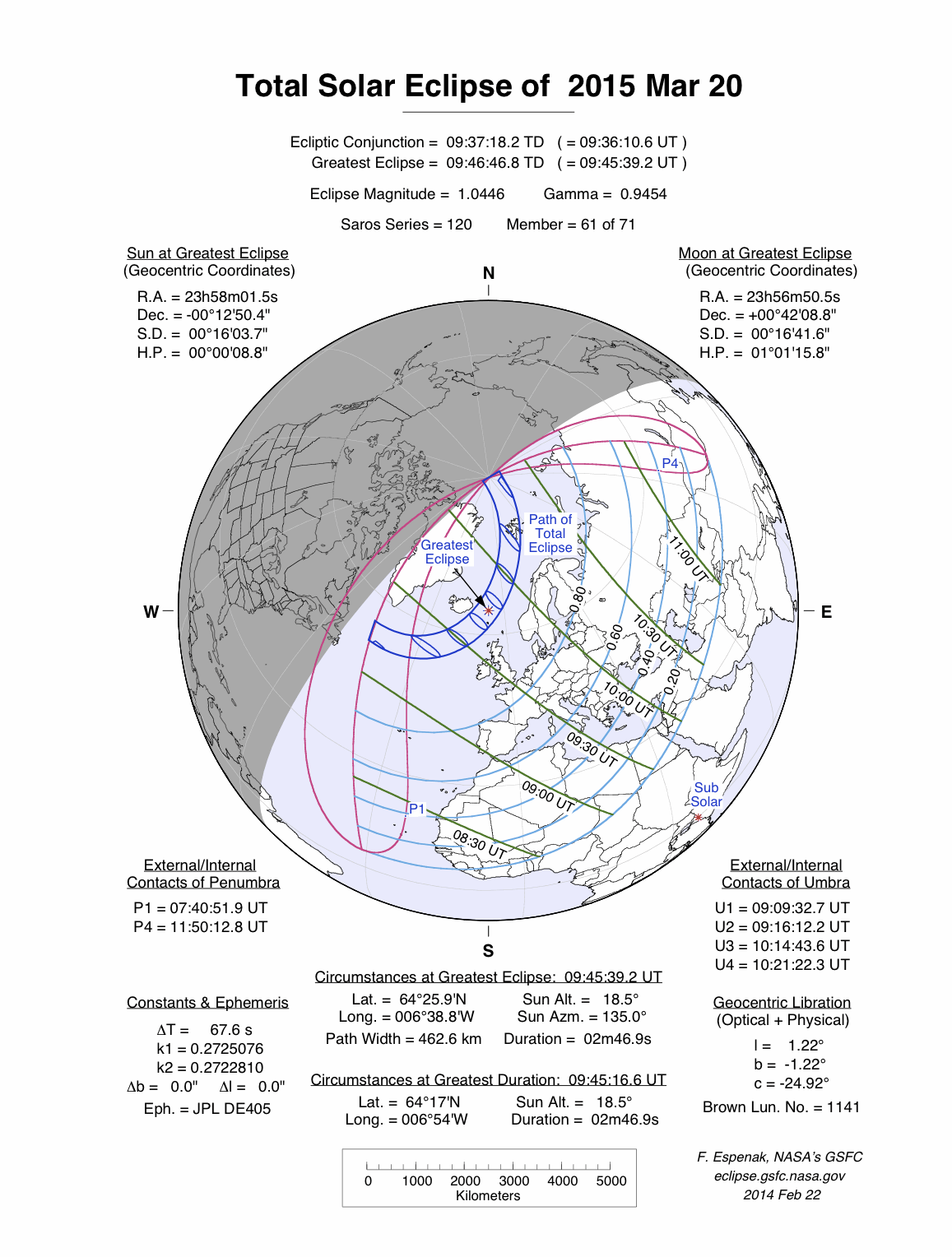
English: Solar eclipse A map of path on earth: Totality exists within the dark blue areas, partiality at the light blue areas. The eclipse occurs at sunrise or sunset in the pink areas. Light blue lines represent a constant fixed fraction of coverage. Green lines show lines of time for greatest coverage. For more information see |
| Date | |
| Source | http://eclipse.gsfc.nasa.gov/ |
| Author | Eclipse Predictions by Fred Espenak, NASA's GSFC |
Licensing
| This file is in the public domain in the United States because it was solely created by NASA. NASA copyright policy states that "NASA material is not protected by copyright unless noted". (See Template:PD-USGov, NASA copyright policy page or JPL Image Use Policy.) | ||
 |
Warnings:
|
Original upload log
The original description page was here. All following user names refer to en.wikipedia.
- 2009-12-08 20:37 SockPuppetForTomruen 728×729× (91056 bytes)
- 2009-11-22 07:43 Tomruen 733×729× (91478 bytes) {{Information |Description = [[Solar eclipse]] map of path on earth |Source = http://eclipse.gsfc.nasa.gov/ |Date = 2000 |Author = Fred |Permission = Official work for NASA |other_versions = }} {{Attribution}} Attribution: '''Eclipse Pr