File:Indo-Aryan language map.svg
Have https://miro.medium.com/v2/1*HPILgvUumtaePBhkrEaufA.png
Summary
| Description |
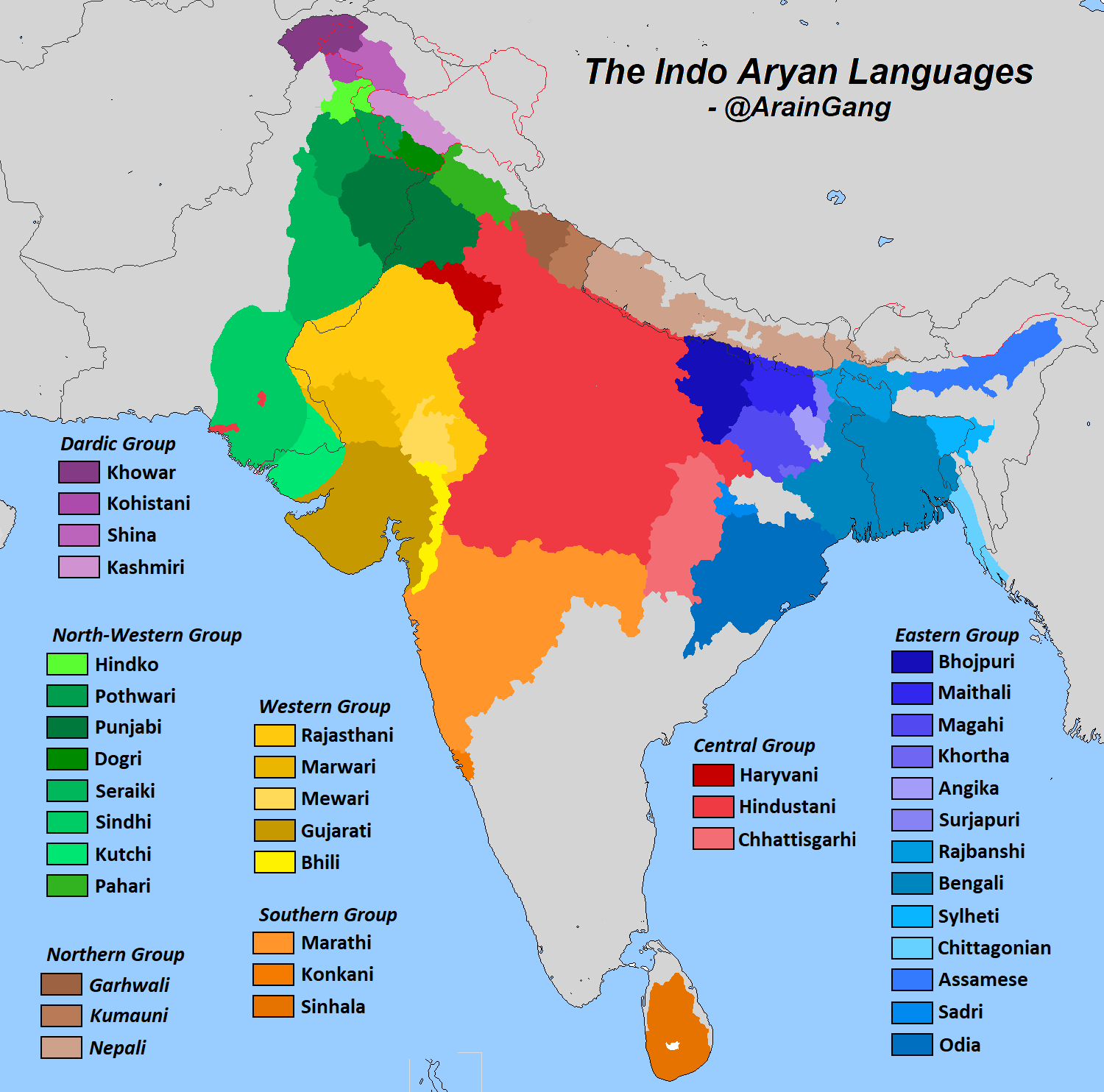
English: Map of major Indo-Aryan languages and language groups. Colors indicate the branches - yellow is Eastern, purple is Dardic, blue is Northwestern, red is Southern, green is Western, brown is Northern and orange is Central. Data is from "The Indo Aryan Languages" as well as census data and previous linguistic maps.
Romani, Domari, Kholosi, Luwati, and Lomavren are outside the scope of the map. Pashai (Dardic)
Khowar (Dardic)
Shina (Dardic)
Kohistani (Dardic)
Kashmiri (Dardic)
Punjabi (Northwestern)
Sindhi (Northwestern)
Rajasthani (Western)
Gujarati (Western)
Khandeshi (Western)
Bhili (Western)
Western Pahari Northern)
Central Pahari (Northern)
Eastern Pahari (Northern)
Western Hindi (Central)
Eastern Hindi (Central)
Bengali-Assamese (Eastern)
Bihari (Eastern)
Odia (Eastern)
Halbic (Eastern)
Marathi-Konkani (Southern)
Sinhala-Dhivehi (Southern)
(not shown: Kunar (Dardic), Chinali-Lahuli (Unclassified) |
| Date | |
| Source | Derivative of File:India location map.svg |
| Author | Own work based on Uwe Dedering |
Licensing
This file is licensed under the Creative Commons Attribution-Share Alike 3.0 Unported license.
- You are free:
- to share – to copy, distribute and transmit the work
- to remix – to adapt the work
- Under the following conditions:
- attribution – You must give appropriate credit, provide a link to the license, and indicate if changes were made. You may do so in any reasonable manner, but not in any way that suggests the licensor endorses you or your use.
- share alike – If you remix, transform, or build upon the material, you must distribute your contributions under the same or compatible license as the original.