File:Europe mediterranean 1190.jpg
Summary
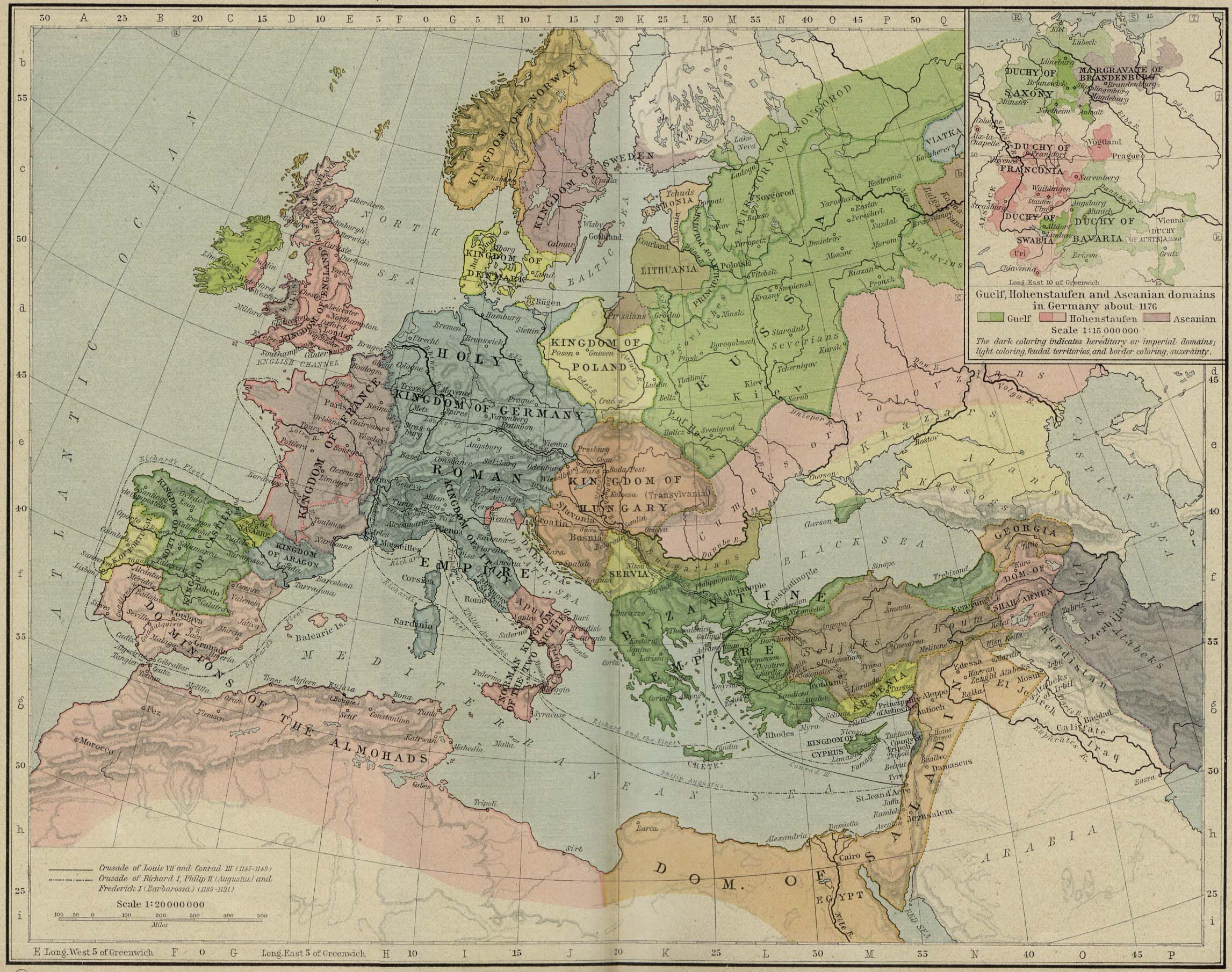
| Description | Europa en 1190. |
| Date | |
| Source | Perry-Castañeda Library, Map Collection: From the "Historical Atlas" by William R. Shepherd, New York, Henry Holt and Company, 1923 |
| Author | Roke |
| Other versions | Category:Images with extracted imagesالعربيَّة |
.jpg)
.jpg)
_en.png)
.png)
.jpg)
Licensing
|
This work is in the public domain in its country of origin and other countries and areas where the copyright term is the author's life plus 70 years or fewer. This work is in the public domain in the United States because it was published (or registered with the U.S. Copyright Office) before January 1, 1931. | |
| This file has been identified as being free of known restrictions under copyright law, including all related and neighboring rights. | |
Category:CC-PD-MarkCategory:PD-old-70-expiredCategory:PD-old-70-expired Category:Atlas To Freeman's Historical Geography Category:Maps of Europe in the 12th century Category:Maps showing history by William R. Shepherd Category:20th-century maps of the Holy Roman Empire#1923 Category:1920s maps showing history#1923
Category:1920s maps showing history
Category:20th-century maps of the Holy Roman Empire
Category:Atlas To Freeman's Historical Geography
Category:CC-PD-Mark
Category:Images with extracted images
Category:Maps of Europe in the 12th century
Category:Maps showing history by William R. Shepherd
Category:PD-old-70-expired
Category:PD-old missing SDC copyright status