File:Europe 526-600.jpg
Summary
| Description |
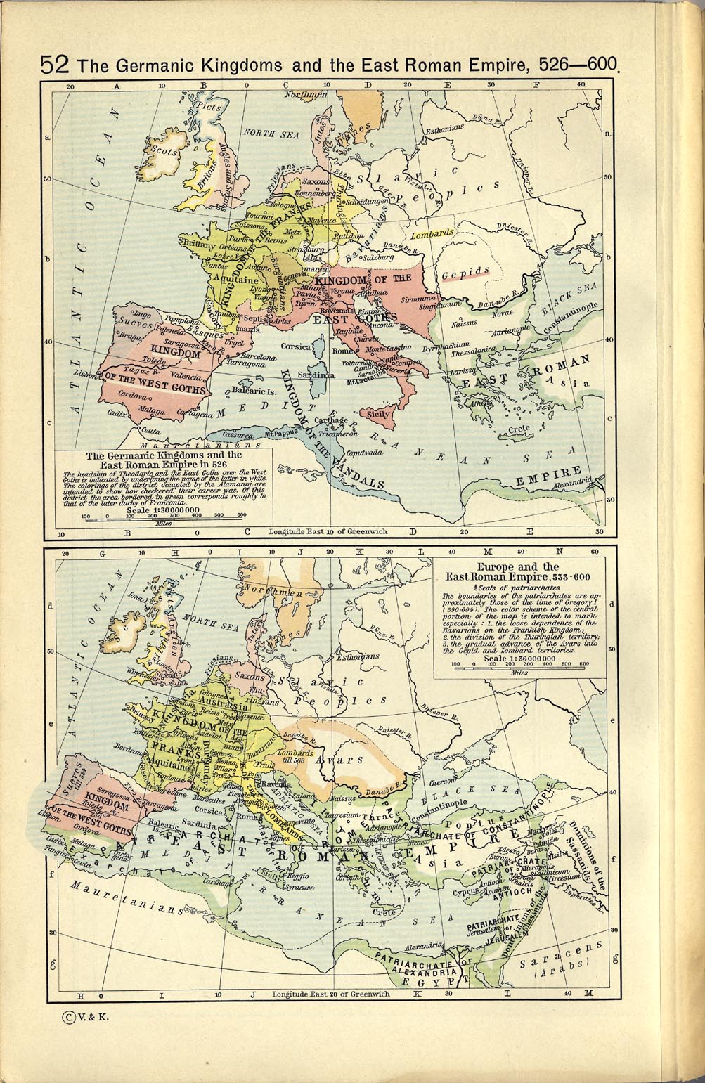
English: A map political map of Europe, situation as of c. 526-600 |
|||||||||||||||||||||||
| Date | ||||||||||||||||||||||||
| Source | Category:PCLShepherd, William R. (1923) Historical Atlas, Category:New York: Henry Holt and Company | |||||||||||||||||||||||
| Author |
|
|||||||||||||||||||||||
| Other versions |
|
|||||||||||||||||||||||
.png)
.jpg)

Licensing
|
The author died in 1934, so this work is in the public domain in its country of origin and other countries and areas where the copyright term is the author's life plus 80 years or fewer. Category:PD-old missing SDC copyright statusThis work is in the public domain in the United States because it was published (or registered with the U.S. Copyright Office) before January 1, 1931. | |
| This file has been identified as being free of known restrictions under copyright law, including all related and neighboring rights. | |
Category:CC-PD-MarkCategory:PD-old-80-expiredCategory:PD-old missing SDC copyright statusCategory:PD-old missing SDC copyright status Category:Maps of Europe in the 6th century Category:Maps of the Merovingian territory Category:Maps showing history of the Early Middle Ages Category:Old maps of Italy Category:Old maps of the history of France Category:Old maps of the Suebi
_en.png)
.png)
.jpg)
Category:CC-PD-Mark
Category:Maps of Europe in the 6th century
Category:Maps of the Merovingian territory
Category:Maps showing history of the Early Middle Ages
Category:Old maps of Italy
Category:Old maps of the Suebi
Category:Old maps of the history of France
Category:PCL
Category:PD-old-80-expired
Category:PD-old missing SDC copyright status