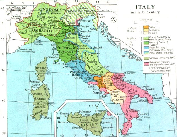
File:Italy and Illyria 1084 AD.svg

| Uploaded by | Ras67 |
|---|---|
| Upload date | 2017-10-22T19:19:43Z |
| MIME type | image/svg+xml |
| Dimensions | 586 × 735 px |
| File size | 522.4 KB |


Summary
| Description |
English: Map of Italy and the Illyrian coast in the year 1084.
Part of a series of maps on the history of Italy:
|
| Date | |
| Source | Own work |
| Author | MapMaster |
| Other versions |
[]
|
| SVG development |


References
- This map from Allyn & Bacon, Longman, textbook publishers.
- Bjorklund, Oddvar; Holmboe, Haakon; Rohr, Anders (1970) Historical Atlas of the World, Barnes & Noble, NY, SBN: 389-00253-4.
- Hammond Atlas Corporation (2007) Hammond Historical World Atlas.
- Matthew, Donald (1989) Atlas of Medieval Europe, Time-Life Books.
- This map of 1000 AD Italy from Fordham University, adapted from Muir's Historical Atlas, (1911).
- This map of 1050 AD Italy, from the 1923 The Historical Atlas by William R. Shepherd
- This Wikipedia map of the w:en:Holy Roman Empire
- Šišić, Ferdo (1990) Povijest Hrvata u vrijeme narodnih vladara & the Baška tablet (to denote the territorial integrity of Croatia; islands, coastal borders etc.)



Licensing
I, the copyright holder of this work, hereby publish it under the following license:


This file is licensed under the Creative Commons Attribution-Share Alike 2.5 Generic license.
- You are free:
- to share – to copy, distribute and transmit the work
- to remix – to adapt the work
- Under the following conditions:
- attribution – You must give appropriate credit, provide a link to the license, and indicate if changes were made. You may do so in any reasonable manner, but not in any way that suggests the licensor endorses you or your use.
- share alike – If you remix, transform, or build upon the material, you must distribute your contributions under the same or compatible license as the original.
derivative works
Derivative works of this file: Italy and Illyria 1084 v2-ar.svg