File:Europe 533-600.jpg
Summary
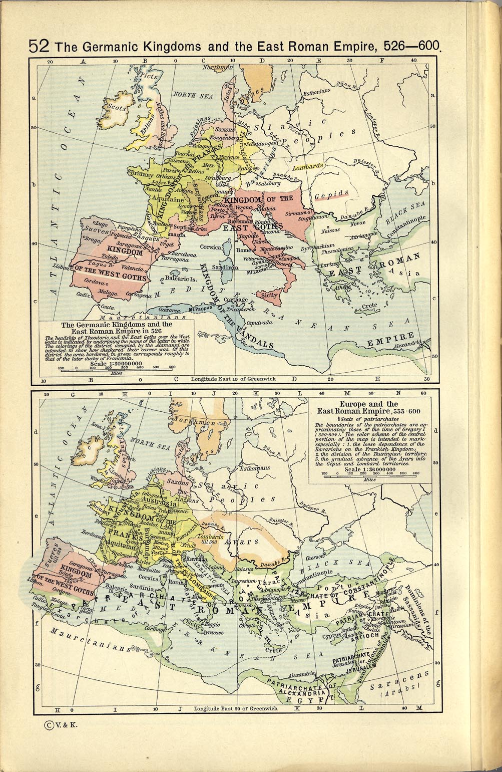
| Description | A map political map of Europe, situation as of c. 526-600 |
| Date | |
| Source | File:Europe 526-600.jpg: The Historical Atlas by William R. Shepherd, 1923. Downloaded from at |
| Author | William R. Shepherd (died 1934) |
Licensing
|
This work is in the public domain in its country of origin and other countries and areas where the copyright term is the author's life plus 70 years or fewer. | |
| This file has been identified as being free of known restrictions under copyright law, including all related and neighboring rights. | |
Category:CC-PD-MarkCategory:PD Old Category:Maps showing history of the Early Middle Ages Category:1923 maps of Europe Category:Old maps of the history of France Category:1923 maps of Italy Category:1923 maps of Germany Category:1923 maps of Spain Category:Maps of the Merovingian territory Category:Maps of Europe in the 6th century Category:1923 maps of Poland Category:Historical Atlas by William R. Shepherd Category:Old maps of the history of Spain Category:Maps with a scale of 1:36,000,000 Category:Old maps of the Suebi
_en.png)
.png)
.jpg)
Category:1923 maps of Europe
Category:1923 maps of Germany
Category:1923 maps of Italy
Category:1923 maps of Poland
Category:1923 maps of Spain
Category:CC-PD-Mark
Category:Historical Atlas by William R. Shepherd
Category:Maps of Europe in the 6th century
Category:Maps of the Merovingian territory
Category:Maps showing history of the Early Middle Ages
Category:Maps with a scale of 1:36,000,000
Category:Old maps of the Suebi
Category:Old maps of the history of France
Category:Old maps of the history of Spain
Category:PD-old missing SDC copyright status
Category:PD Old