File:Holy Roman Empire 1648-sr.png

| Uploaded by | Obsuser |
|---|---|
| Upload date | 2017-08-27T05:09:16Z |
| MIME type | image/png |
| Dimensions | 1142 × 907 px |
| File size | 671.1 KB |
Summary
| Description |
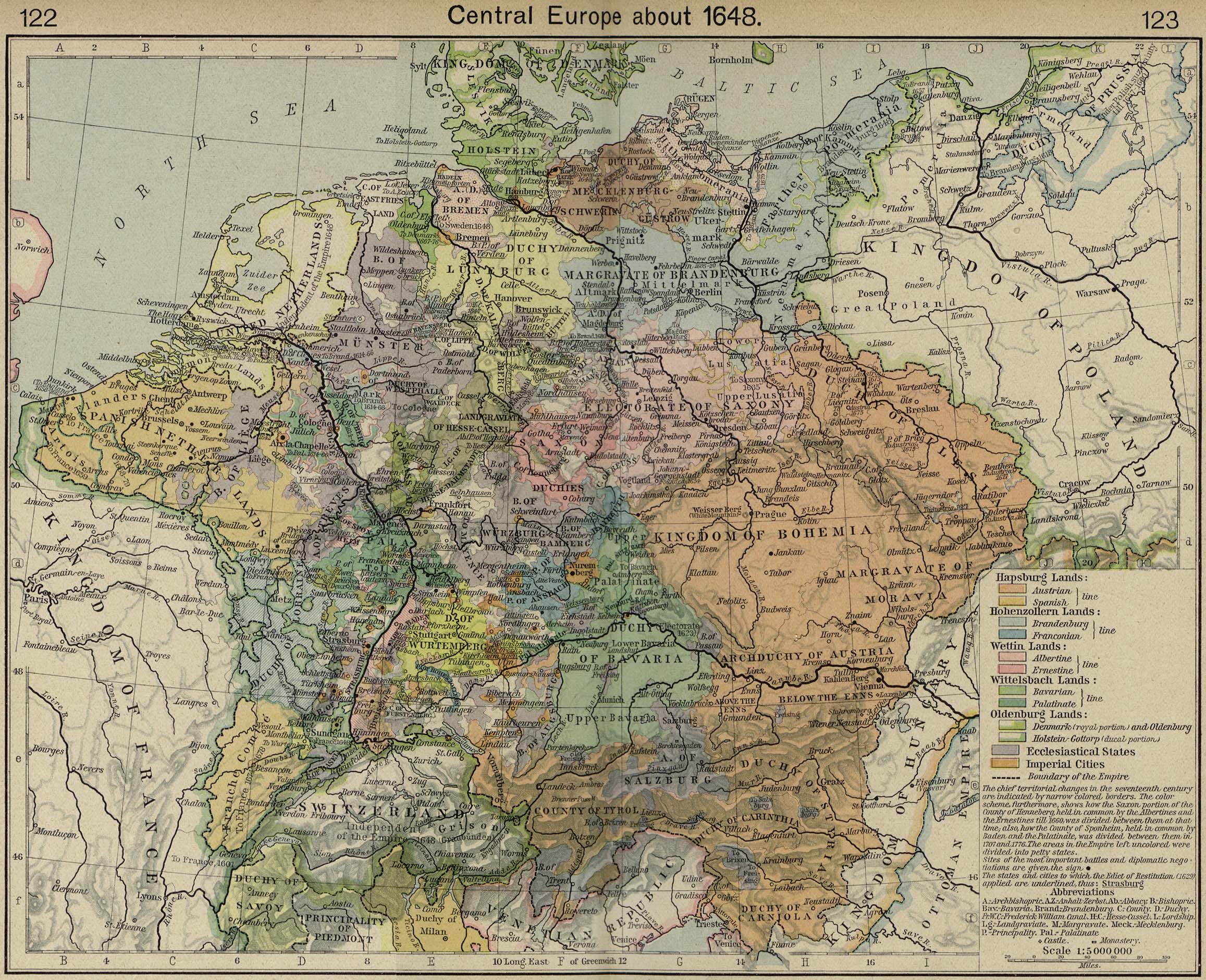
Map of the Holy Roman Empire in 1648, after the Peace of Westphalia. This is a png version of the original svg. Uses the colour scheme of Wikipedia:WikiProject Maps and the free to use Color Brewer.
Ecclesiastical lands
Swedish after 1648
|
| Date | |
| Source |
Made from the public domain map from the Perry-Castañeda Library Map Collection at the University of Texas |
| Author | Astrokey44; translation: Obsuser |
| Permission (Reusing this file) |
self made |


Licensing

|
Permission is granted to copy, distribute and/or modify this document under the terms of the GNU Free Documentation License, Version 1.2 or any later version published by the Free Software Foundation; with no Invariant Sections, no Front-Cover Texts, and no Back-Cover Texts. A copy of the license is included in the section entitled GNU Free Documentation License. |
  
|
This file is licensed under the Creative Commons Attribution-Share Alike 3.0 Unported license. | |
| ||
| This licensing tag was added to this file as part of the GFDL licensing update. |