File:Ostrvo-Vis.svg
Summary
| Description |
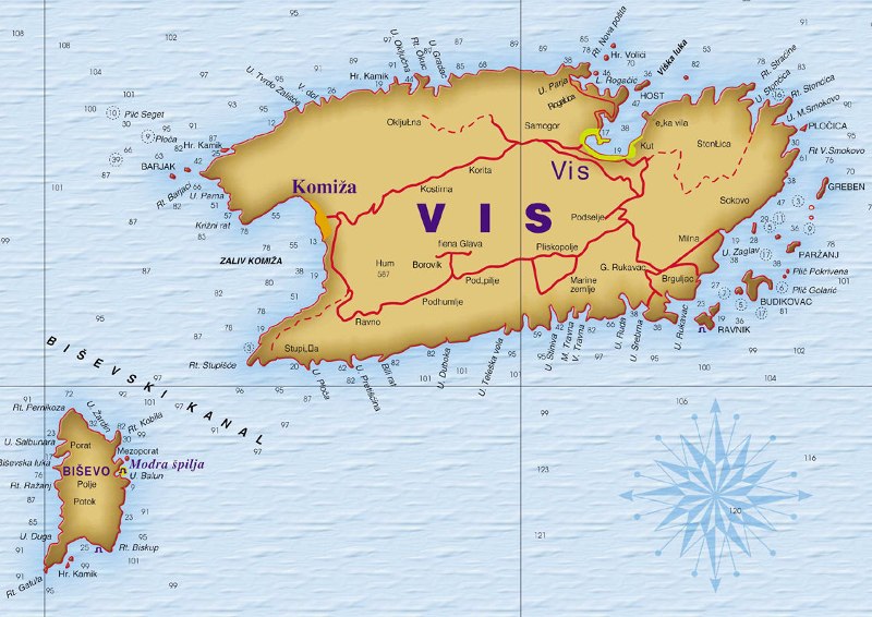
English: Topographic map of island Vis, Croatia, Adriatic Sea (in Serbian).
Hrvatski: Zemljopisna karta otoka Vis sa okolicom, Hrvatska (na srpskom).
Српски / srpski: Tопографска мапа острва Вис са околином, Хрватска (српски). |
| Date | |
| Source |
|
| Author |
Иван Матејић Ivan Matejić |
Licensing
I, the copyright holder of this work, hereby publish it under the following licenses:
 |
Permission is granted to copy, distribute and/or modify this document under the terms of the GNU Free Documentation License, Version 1.2 or any later version published by the Free Software Foundation; with no Invariant Sections, no Front-Cover Texts, and no Back-Cover Texts. A copy of the license is included in the section entitled GNU Free Documentation License. |
This file is licensed under the Creative Commons Attribution 3.0 Unported license.
- You are free:
- to share – to copy, distribute and transmit the work
- to remix – to adapt the work
- Under the following conditions:
- attribution – You must give appropriate credit, provide a link to the license, and indicate if changes were made. You may do so in any reasonable manner, but not in any way that suggests the licensor endorses you or your use.
You may select the license of your choice.