File:Eyjafjallajökull volcanic ash 19 April 2010.png
| Description |
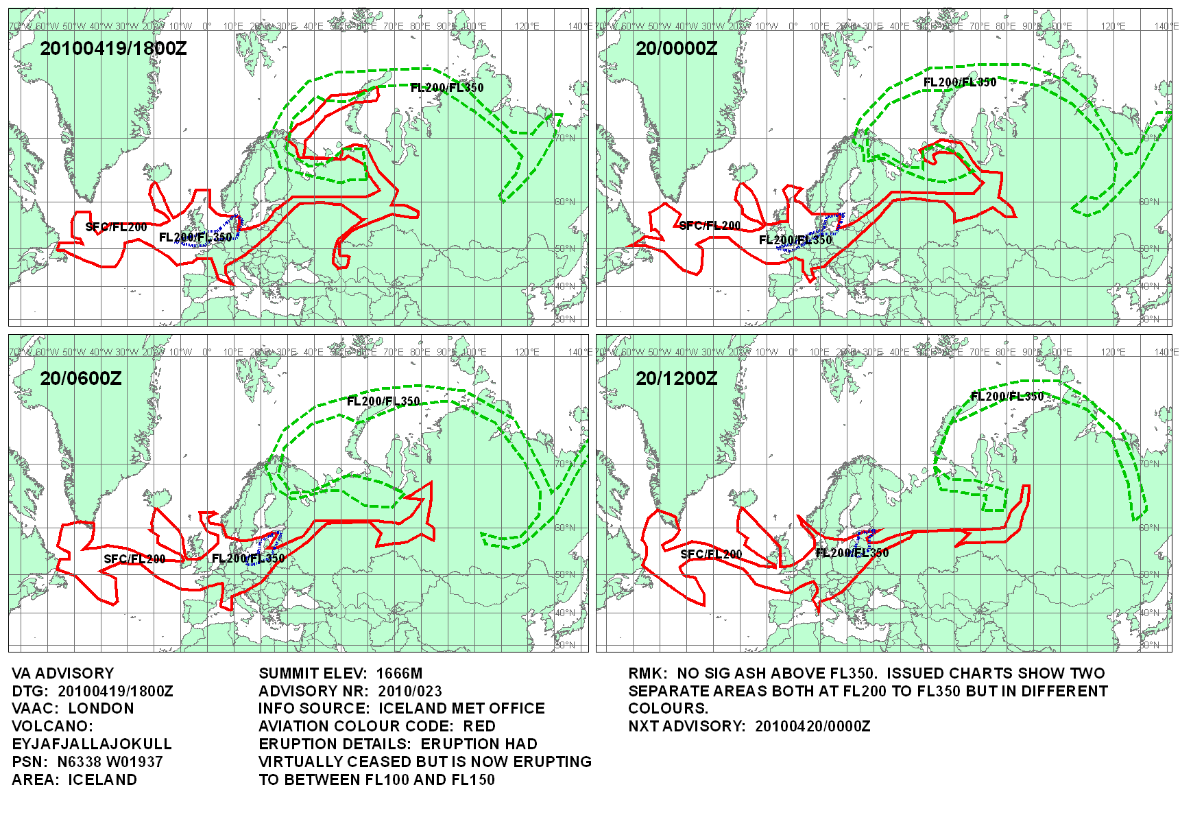
This map shows the Icelandic volcanic ash cloud that closed European air space as of 19 April 2010 at 18:00 UTC. Based on http://www.metoffice.gov.uk/aviation/vaac/data/VAG_1271698086.png Editable XCF file: File:Eyjafjallajökull_volcanic_ash_19_April_2010.xcf |
| Date | (UTC) |
| Source | |
| Author |
|
 |
This is a retouched picture, which means that it has been digitally altered from its original version. Modifications: added the volcanic ash cloud. The original can be viewed here: Blankmap-ao-090N-north pole.xcf:  . Modifications made by Cogiati. . Modifications made by Cogiati.
|


This file is licensed under the Creative Commons Attribution-Share Alike 3.0 Unported license.
- You are free:
- to share – to copy, distribute and transmit the work
- to remix – to adapt the work
- Under the following conditions:
- attribution – You must give appropriate credit, provide a link to the license, and indicate if changes were made. You may do so in any reasonable manner, but not in any way that suggests the licensor endorses you or your use.
- share alike – If you remix, transform, or build upon the material, you must distribute your contributions under the same or compatible license as the original.

Original upload log
This image is a derivative work of the following images:
- File:Blankmap-ao-090N-north_pole.xcf licensed with PD-user
- 2005-10-13T11:43:00Z Reisio 0x0 (791205 Bytes) Created by [[:en:User:Reisio|User:Reisio]] with [[:en:Generic Mapping Tools|GMT]] & [[:en:GIMP|GIMP]].{{pd}}
Uploaded with derivativeFX Category:Uploaded with derivativeFX
Category:VAACUK maps of Eyjafjallajökull 2010 eruption Category:Maps of the northern hemisphere Category:2010-04-19