File:Turkey map.svg
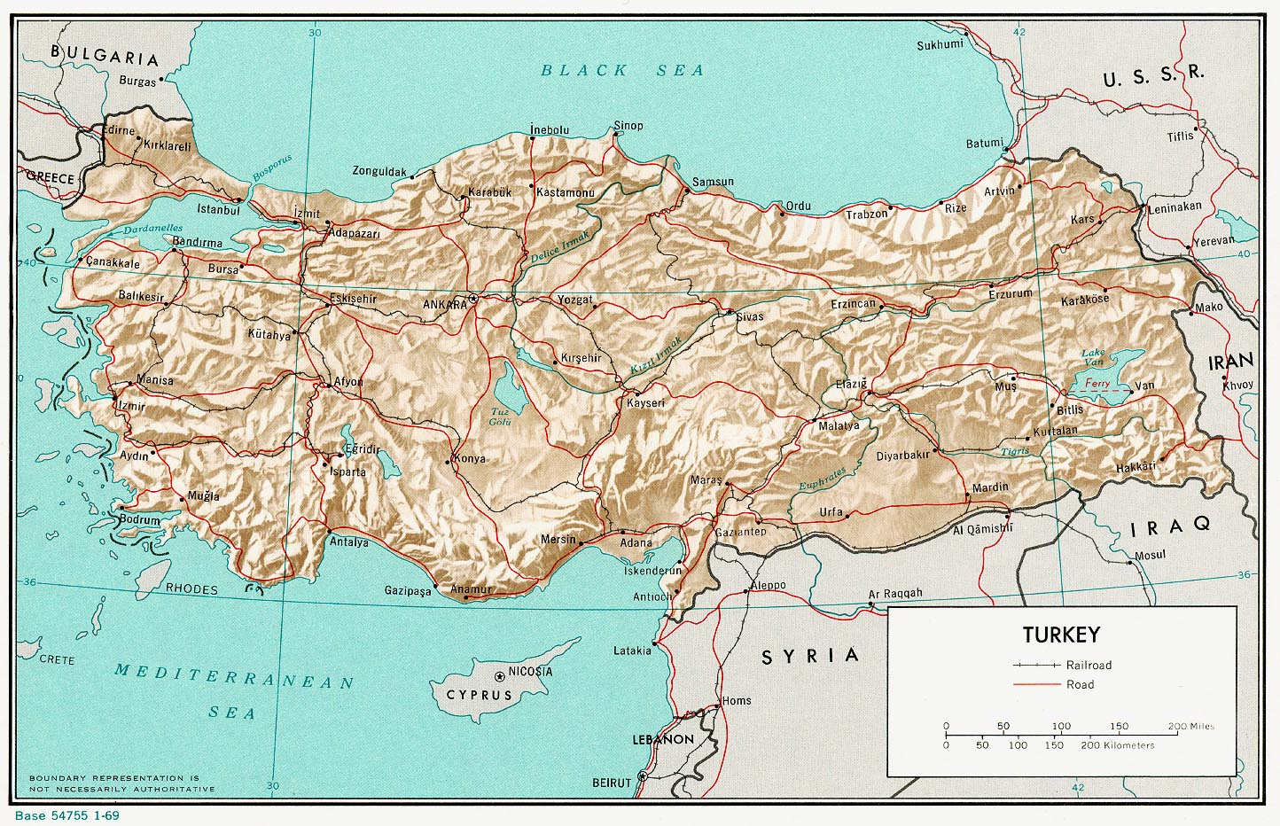
| Description | Turkey and major cities |
| Date | |
| Source | inkscape and the two pictures (see at other versions) helped me when tracing; if you change it, be aware of the fact that I introduced by hand a css class for the cities! |
| Author | Thomas Steiner |
| Permission (Reusing this file) |
Thomas Steiner put it under the CC-by-SA 2.5. |
| Other versions |
Derivative works of this file: Image:Tu-map.png and de:Bild:Tuerkei topo.jpg, , (not yet) |
This file is licensed under the Creative Commons Attribution-Share Alike 2.5 Generic license.
- You are free:
- to share – to copy, distribute and transmit the work
- to remix – to adapt the work
- Under the following conditions:
- attribution – You must give appropriate credit, provide a link to the license, and indicate if changes were made. You may do so in any reasonable manner, but not in any way that suggests the licensor endorses you or your use.
- share alike – If you remix, transform, or build upon the material, you must distribute your contributions under the same or compatible license as the original.
Possible improvements:
- more cities: Ani, Dogubeayzit, Efesos, Pergamon, Perge, Aspendos, Termessos, Myra, Xantos, Ahtamar, Hierapolis (Pamukkale), Hattusa, Nemrut Dagi, Side, Alanya, Silifke, Nevsehir, Abant, Göreme, Hasankeyf, Urfa, Midiyat (Tur ab Din), Artvin, Antakya, ...
- rivers: büyük menderes, ...
- colors
This W3C-unspecified vector image was created with Inkscape .Category:Unspec New SVG created with Inkscape#{{padleft:{{%23expr:{{CURRENTYEAR}} -{{REVISIONYEAR}}}}%7C2%7C0}}{{padleft:{{%23expr:{{CURRENTMONTH2}}-{{REVISIONMONTH}}}}%7C2%7C0}}{{padleft:{{%23expr:{{CURRENTDAY2}} -{{REVISIONDAY2}}}}%7C2%7C0}}