File:Www.wesleyjohnston.com-users-ireland-maps-historical-map1014.gif
Summary
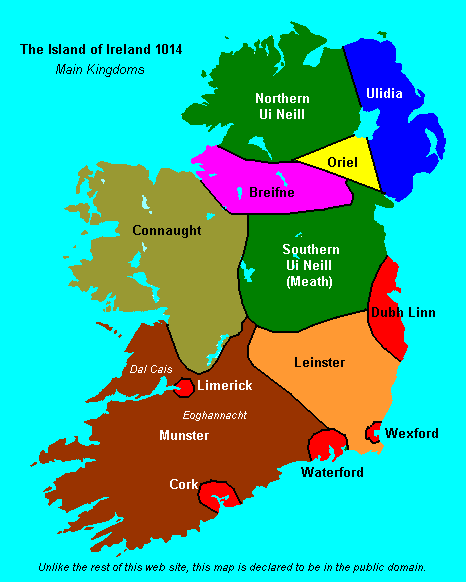
Historical map of Ireland circa 1014 from http://www.wesleyjohnston.com/users/ireland/maps/historical/map1014.gif
 |
File:Www.wesleyjohnston.com-users-ireland-maps-historical-map1014-es.svg is a vector version of this file. It should be used in place of this GIF file when not inferior.Category:Vector version available
File:Www.wesleyjohnston.com-users-ireland-maps-historical-map1014.gif → File:Www.wesleyjohnston.com-users-ireland-maps-historical-map1014-es.svg
For more information, see Help:SVG. |
 |

Licensing
 |
The copyright holder of this file, The Ireland Story, allows anyone to use it for any purpose, provided that the copyright holder is properly attributed. Redistribution, derivative work, commercial use, and all other use is permitted. |
Attribution:
The Ireland Story |
Category:Atlas entries in progress fase 9
Category:Attribution only license
Category:Files with no machine-readable author
Category:Files with no machine-readable source
Category:Images with inappropriate GIF format
Category:Maps of Ireland in the 11th century
Category:Maps showing 1014
Category:Media missing infobox template
Category:Vector version available