File:Area of Battle of Milne Bay 1942.jpg
 |
This military map image could be re-created using vector graphics as an SVG file. This has several advantages; see Commons:Media for cleanup for more information. If an SVG form of this image is available, please upload it and afterwards replace this template with {{vector version available|new image name}}.It is recommended to name the SVG file “Area of Battle of Milne Bay 1942.svg”—then the template Vector version available (or Vva) does not need the new image name parameter. |


| Description |
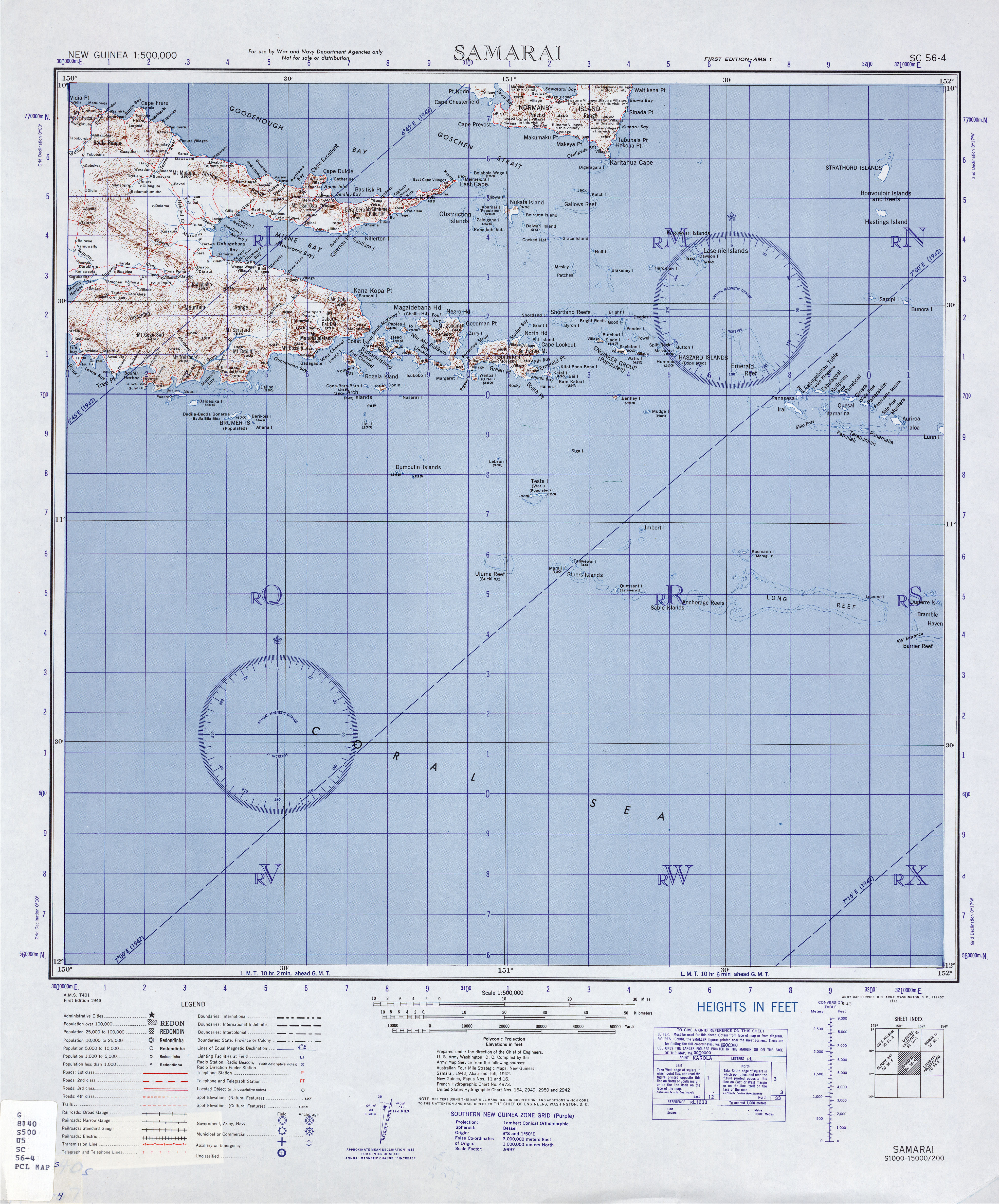
English: Part of Milne Bay that was the focus of the Battle of Milne Bay, September 1942. Note: no two maps of this area agree in topography or nomenclature. Please contact the author SpoolWhippets (talk) 04:22, 3 April 2010 (UTC) if you have corrections. |
| Date | |
| Source |
(Original text : Own work created in Adobe Fireworks
|
| Author | Chris Rees User:SpoolWhippets |
Licensing
SpoolWhippets at English Wikipedia, the copyright holder of this work, hereby publishes it under the following license:
This file is licensed under the Creative Commons Attribution 3.0 Unported license.
Attribution:
- You are free:
- to share – to copy, distribute and transmit the work
- to remix – to adapt the work
- Under the following conditions:
- attribution – You must give appropriate credit, provide a link to the license, and indicate if changes were made. You may do so in any reasonable manner, but not in any way that suggests the licensor endorses you or your use.
Original upload log
Transferred from en.wikipedia to Commons by Sreejithk2000 using CommonsHelper.
The original description page was here. All following user names refer to en.wikipedia.
- 2010-04-03 04:24 SpoolWhippets 315×257× (59076 bytes) Added Taupota on nth coast
- 2010-03-29 12:32 SpoolWhippets 315×257× (57482 bytes) Consistency with other PNG campaign maps
- 2010-03-27 13:27 SpoolWhippets 630×550× (262012 bytes) == {{int:filedesc}} == <br/>{{Information |Description=Map indicating location of Milne Bay within Papua andisland of New Guinea, also relative to Australia. |Source=Own work created in Adobe Fireworks<br/> *Data sources: **Coastlines: http://www.lib.utex
Category:Battle of Milne Bay
Category:CC-BY-3.0
Category:Images with inappropriate JPEG compression
Category:JPG images that should use vector graphics
Category:Maps of the New Guinea campaign
Category:Military map images that should use vector graphics
Category:Milne Bay
Category:Self-published work